Find Maps You’ll Love
Whether you’re looking for luxury or value, our range of Maps has something for everyone.
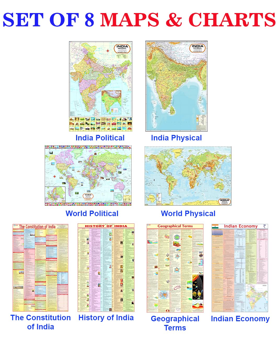
World & India Map (Both Political & Physical) with Constitution of India, Indian History, Indian Economy & Geographical Terms Chart | Set Of 8
Great Maps: The World's Masterpieces Explored and Explained
Rand McNally United States Interstate Fold Map Map – Folded Map, March 1, 2024
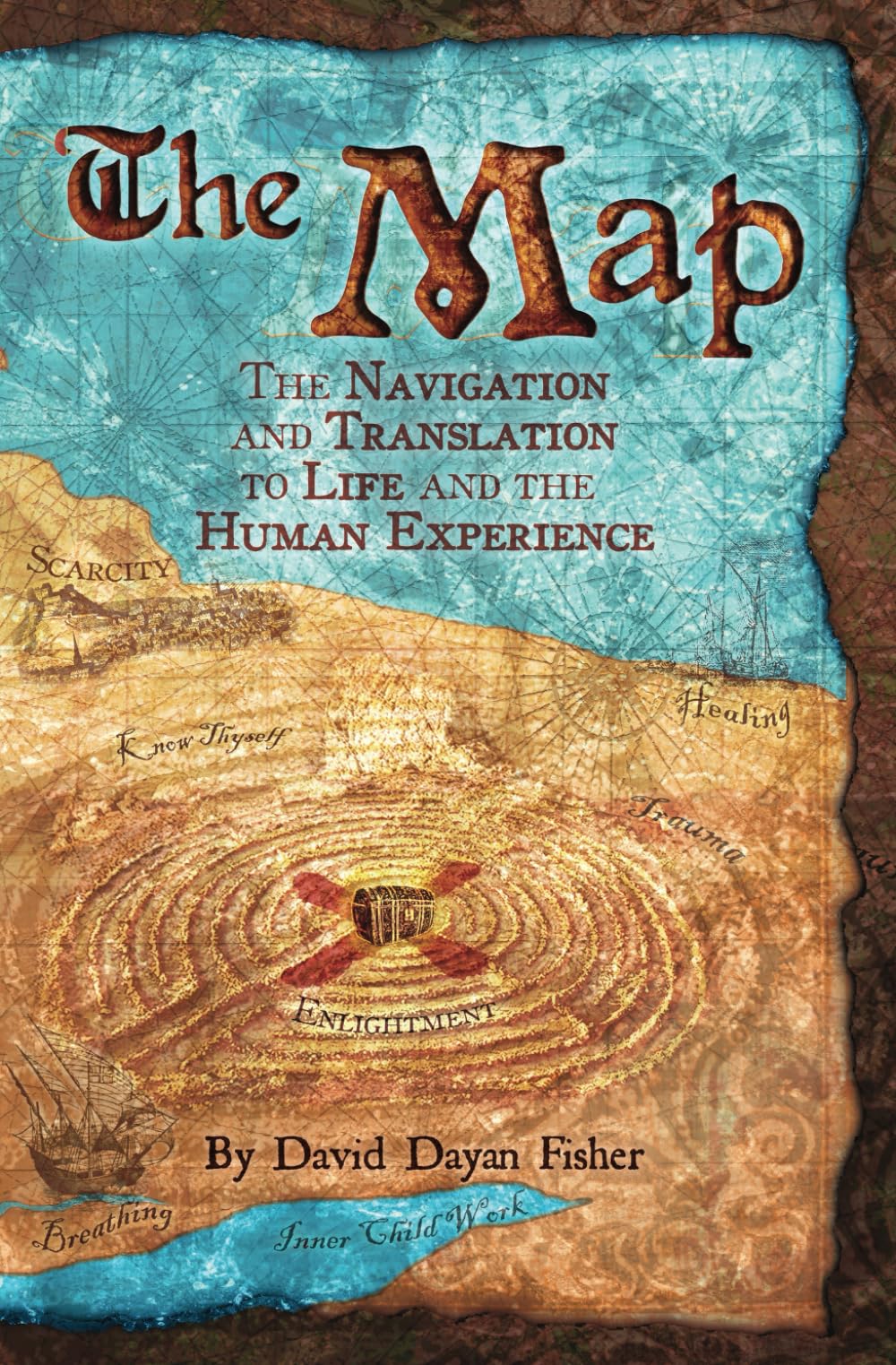
The Map: The navigation & translation to life & the human experience
Outline Practice map of India and World (Both Political and Physical map) | A-4 BIG SIZE | Set Of 100 Maps | Printed on High Grade Paper
Rand McNally Midsize Easy to Read Road Atlas 2025
Maps: Aleksandra Mizielinska - Daniel Mizielinski
National Geographic Maps: World Executive Wall Map - Poster Size - Antique Style - 91 x 61 cm - Folded Map
World Map Poster for Wall – 84 x 60cm Large Wall Map of World – World Map Wall Art Atlas - Map of Europe Travel Map - Classroom or Geography Gift
Laminated World Map & US Map Poster Set - 18" x 29" - Wall Chart Maps of the World & United States - Made in the USA (LAMINATED)
The Ordnance Survey Puzzle Book: Pit your wits against Britain's greatest map makers from your own home! Paperback – 18 Oct. 2018
National Geographic Road Atlas 2025: Scenic Drives Edition [United States, Canada, Mexico] (National Geographic Recreation Atlas)
National Geographic Road Atlas 2025: Adventure Edition [United States, Canada, Mexico] Spiral-bound – June 10, 2024
Rand McNally Folded Map: Eastern United States
A History of the World in 500 Maps
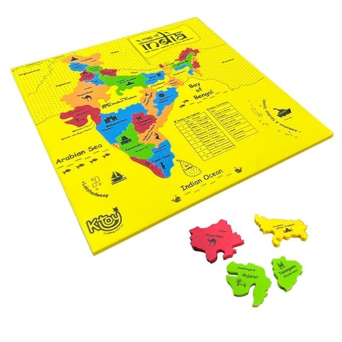
Imagimake Mapology India with State Capitals - Educational Toy and Learning Aid for Boys and Girls - India Map Puzzle - Jigsaw Puzzle, 25 Pieces, Kids
India & World Map ( Both Political & Physical ) with Constitution of India, Indian History, Indian Economy & Geographical Terms Chart | Set Of 8 | Useful for UPSC and other competitive exam preparation | by Hivex Publication Product Bundle – Wall Map, 30 December 2021
Rand McNally Large Scale Road Atlas 2025 Spiral-bound – Folded Map, March 14, 2024
India & World Map ( Both Political & Physical ) with Constitution of India Chart, History of India Chart & Geography Terms Chart | Set Of 7 | Useful for UPSC and other exams | By VCP Product Bundle – Folded Map, 1 January 2021
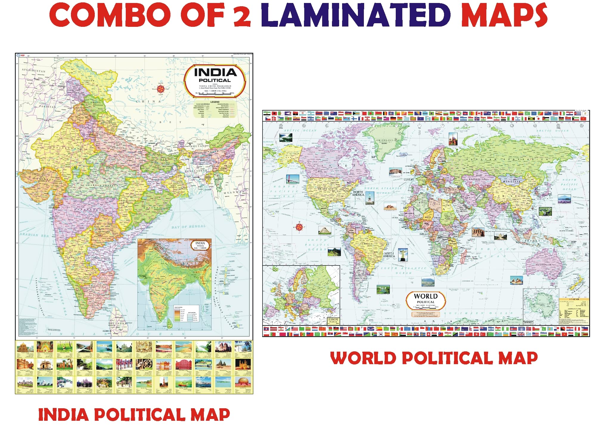
India and World Political Map - LAMINATED | Size - 70×100cm | India Map | World Map Unknown Binding – 30 December 2021
Complete set of UPSC Maps & Charts | set of 11 | India & World Map ( Both Political & Physical ) with Constitution of India, Constitutional Amendments, Indian History, Indian Economy, Geographical Terms, Geography of India, and UPSC Prelims Syllabus Chart | NON LAMINATED
STRIFF World Map Extended Size (800 mm x 300 mm x 2 mm) Gaming Mouse Pad| Desk Mat | Stitched Edges| Non-Slip Rubber Base|Computer Laptop|Keyboard Mouse Pad for Office & Home (World Map)
Great Maps: The World's Masterpieces Explored and Explained (DK History Changers)
Rand McNally Classic Edition World Wall Map – Laminated Rolled Map – December 3, 2021
Scratch The World® Travel Map - Scratch Off World Map Poster with Gift Tube - X-Large - 84 x 59 cm - Maps International - 50 Years + of Map Making
2 Pack - Laminated World Map Poster & USA Map Set - Equal Earth world map design shows continents at true relative size - US Map 18” x 29”
Prisoners of Geography: Ten Maps That Explain Everything About the World (Politics of Place Book 1)
Imagimake: Mapology World- World Map and Its Countries- Learning Aid & Educational Toy- Jigsaw Puzzle- for Kids Age 4 and Above (Mapology World)
MAP Master Amino Acid Pattern
TOYSCAPE Foam India Map Puzzle | Learn Indian States and Capitals, Geography for Kids, Learning & Educational Toys | 30 Pieces Puzzles for Kids Ages 4+
Snowdon / Yr Wyddfa Map | Conwy Valley / Dyffryn Conwy | Ordnance Survey | OS Explorer Map OL 17 | Wales | Walks | Hiking | Maps | Adventure
Rand McNally 2025 Road Atlas & National Park Guide
Wooden India Map Puzzle for Kids with States, Their Capitals, 18 Pieces with Knobs | Educational Wooden Puzzle Games for Boys and Girls | Map of India Puzzle for Kids | Jigsaw Puzzle Games for Kids
National Geographic World Map (folded with flags and facts) (National Geographic Reference Map)
Maps International - World Map - Updated 2024 - Front Sheet Lamination - 118.9cm (w) x 84.1cm (h)
2 Pack - Laminated World Map & US Map Poster Set - Wall Chart Map of the World & United States - Made in the USA [Yellow]
National Geographic Concise Atlas of the World, 5th edition: Authoritative and complete, with more than 200 maps and illustrations
Imagimake: Mapology India and World Maps with Capitals - Learn Capitals and Country Flags - Educational Toy for Kids Above 5 Years, Multicolor
The Map: The navigation & translation to life & the human experience Paperback – October 5, 2024
India & World Map Combo | LAMINATED | Size : 70 X 100 cm | India Map | World Map
Imagimake Mapology India Map Puzzles - Geography for Kids - Learning & Educational Toys - Puzzles for Kids Ages 4-8 - Gift for 4, 5, 6, 7, 8 Year Old Boys & Girls
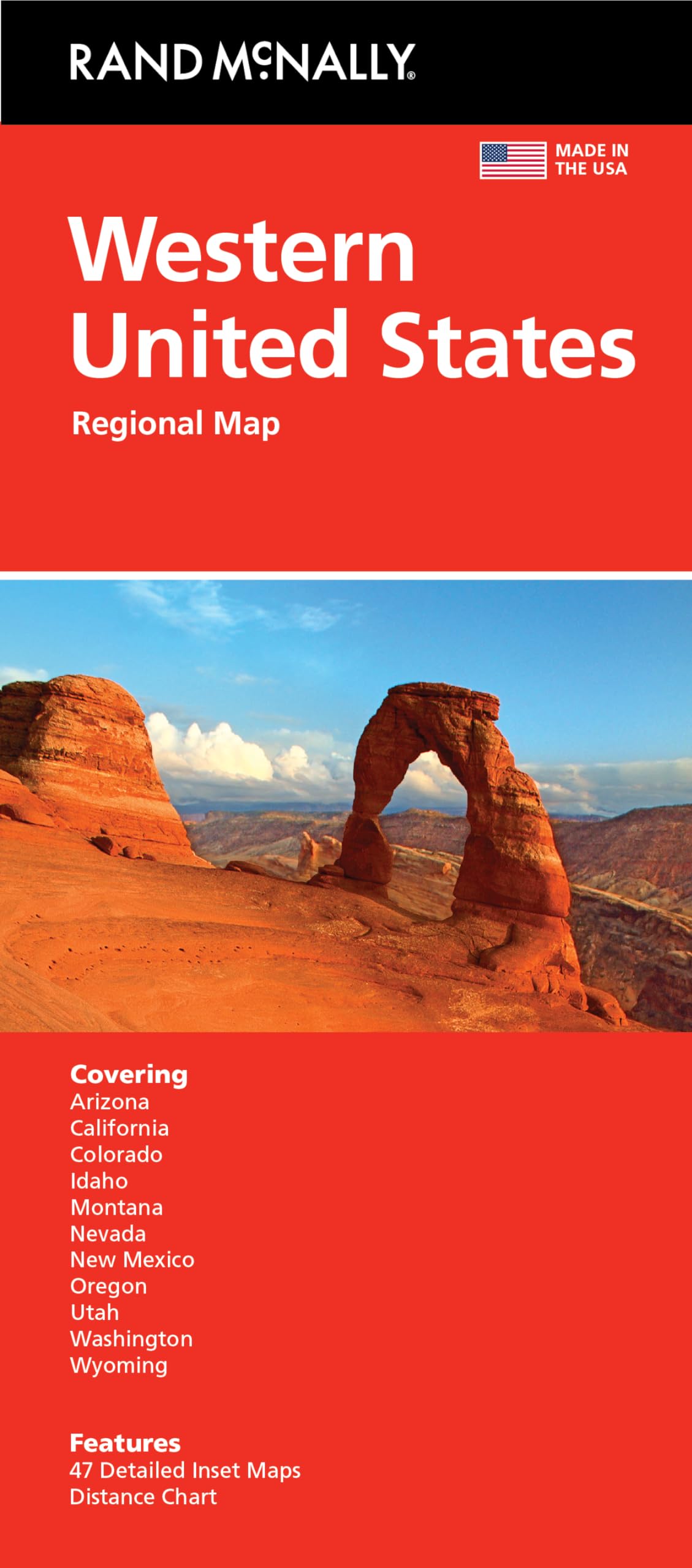
Rand McNally Folded Map: Western United States
2025 Philip's Big Easy to Read Britain Road Atlas: (A3 Spiral Binding) (Philip's Road Atlases) Spiral-bound – 4 April 2024
Rose Book of Bible Charts, Maps, and Time Lines
World Map : Political | Laminated Both Sides | 70 x 100 cm ( Big Map )


![National Geographic Road Atlas 2025: Scenic Drives Edition [United States, Canada, Mexico] (National Geographic Recreation Atlas)](https://m.media-amazon.com/images/I/814R4OsGtCL.jpg)
![National Geographic Road Atlas 2025: Adventure Edition [United States, Canada, Mexico] Spiral-bound – June 10, 2024](https://m.media-amazon.com/images/I/81rRihqWqgL.jpg)


![2 Pack - Laminated World Map & US Map Poster Set - Wall Chart Map of the World & United States - Made in the USA [Yellow]](https://m.media-amazon.com/images/I/91d58tGhj2L.jpg)